
4 BIM in Design and Construction for Large Civil Infrastructure: Transitioning from 2D to 3D Coordination in Complex Projects
Rahul Varma Alluri
This title reflects the shift from traditional workflows to model-based collaboration in large infrastructure projects such as highways, transit systems, airports, tunnels, and civic buildings.
Rationale for Studying the Case
As civil infrastructure projects became more complex, the adoption of Building Information Modeling (BIM) promised better coordination and efficiency. However, these gains were only realized when the shift to 3D modeling was matched by changes in team communication, planning, and institutional norms. Studying this case revealed how organizations attempted to modernize their practices alongside technological tools.
Motivation for the Problem
Although BIM tools were increasingly available, many large infrastructure projects continued to struggle with poor coordination, rework, and delays. The issue was not a lack of software—it was the challenge of adapting existing design and construction processes to fully leverage 3D model-based workflows.
Purpose
The purpose of this study was to explore how transitioning from 2D to 3D design impacted collaboration, communication, and decision-making practices on large infrastructure projects. The case aimed to identify the organizational, legal, and cultural shifts that accompanied digital transformation in civil construction.
Research Question
How did large-scale civil infrastructure project teams adapt their workflows when transitioning from 2D to 3D coordination using BIM tools—and was this transition feasible and advantageous in terms of collaboration, efficiency, and project outcomes?
Focus
The focus was on complex civil infrastructure projects (e.g., transportation systems, tunnels, airports, urban civic structures) where multiple disciplines needed to coordinate. The boundary excluded small-scale or purely architectural projects. This was a qualitative, secondary case based on published research, not direct field observation.
Facts Related to the Case
-
2D-based coordination was prone to misalignment and on-site clashes.
-
BIM enabled clash detection, spatial coordination, and early validation.
-
However, BIM also required new communication routines, updated roles, and legal/institutional reform.
-
Teams often struggled to integrate these changes smoothly, especially across contractors, designers, and labor.
The Data I Collected
I collected data from published case studies and journal articles (e.g., Neff & Dossick’s ethnographic studies on BIM projects).
I reviewed academic literature on BIM workflows, adoption challenges, and legal barriers.
I analyzed documents such as BIM standards (e.g., ISO 19650), white papers, and BIM implementation guides.
I applied theoretical frameworks such as “seeing together,” “messy talk,” and “writing institutions” to explain how teams adapted to technological change.
No field interviews or company-specific reports were collected. The case was entirely based on existing scholarly and industry literature.
The Patterns or Theories I Explored
- Seeing Together – Visual collaboration using shared 3D environments.
- Messy Talk – Informal dialogue that enabled flexibility in problem-solving.
- Writing Institutions – The way contracts and risk management practices shaped BIM adoption.
- Cultural Adaptation – Shifts in team norms, communication styles, and workflows in response to BIM.
Connection to the Larger Scheme of Things
Understanding how BIM changed work practices on large infrastructure projects helped inform the future of digital construction. These insights could guide governments, construction firms, and educators in preparing for an industry increasingly reliant on digital tools, automation, and integrated planning.
1. ABSTRACT
As civil infrastructure projects become more complex, the traditional reliance on 2D drawings for coordination and execution is proving increasingly inadequate. Building Information Modeling (BIM) introduces a transformative paradigm shift, enabling integrated, three-dimensional, data-rich models that streamline collaboration, reduce errors, and enhance lifecycle asset management. The transition from 2D to 3D coordination through Building Information Modeling (BIM) is reshaping large-scale civil infrastructure. This case study explores the organizational, technological, and cultural challenges of implementing BIM across complex civil projects such as highways, bridges, tunnels, and airports. Through extensive secondary research, this study examines the effectiveness of BIM in real-world infrastructure projects, focusing on improvements in collaboration, rework mitigation, data management, and lifecycle integration. Drawing on theoretical frameworks like “Seeing Together” and “Writing Institutions” by Neff and Dossick, and real-world implementations from the Kentucky Transportation Cabinet, Turner Construction, Scandinavia’s Total BIM strategy, Autodesk contractors, and Korea’s KICT data framework, this case goes deep into the systemic transformation brought by BIM. The study also explores software tools, implementation strategies, visualization platforms, and offers a comprehensive analysis of their use across the construction lifecycle.
This case study investigates the practical application of BIM in large-scale infrastructure, drawing on scholarly frameworks and real-world examples to explore how project teams transition from 2D to 3D workflows. It analyzes implementation strategies across highways, tunnels, airports, and rail systems, highlighting both the technological tools and the organizational adjustments required. Through examples from the Kentucky Transportation Cabinet (KYTC), Turner Construction’s SeaTac project, Total BIM in Scandinavia, Korea’s KICT integration platform, and United-BIM’s private sector projects, the study illustrates not only the technical processes involved but also the cultural and contractual reforms that underpin successful adoption. The research demonstrates that BIM’s value is fully realized only when digital tools are embedded within restructured communication, planning, and institutional practices.
This case study further incorporates insights from an interview with Justin Lopez, BIM Program Manager at Sound Transit, whose experience overseeing BIM strategy on multi-billion-dollar light rail expansions in the Pacific Northwest exemplifies the organizational, cultural, and contractual dimensions of BIM adoption. His reflections on virtual walkthroughs, stakeholder engagement, and the transition toward digital twins provide a critical firsthand perspective.
2. INTRODUCTION
The global construction industry is undergoing a profound digital transformation, and large-scale civil infrastructure lies at the heart of this change. From bridge construction to underground tunneling and airport expansion, infrastructure projects involve a complex web of stakeholders, contracts, and design disciplines. Traditionally, coordination among these actors was handled through stacks of 2D drawings, specification sheets, and physical mockups. However, this analog process is fraught with challenges—misinterpretation of drawings, disconnected teams, reactive problem solving, and delays due to poorly communicated design changes.
Building Information Modeling (BIM) addresses these challenges by offering a collaborative digital environment where multiple stakeholders can work within a shared 3D model. This model is not simply a visualization tool; it is a central repository of geometric, technical, temporal, and performance-related data that evolves throughout the project lifecycle. In infrastructure contexts, BIM’s promise lies not only in reducing clashes and change orders, but also in enabling early-stage decision making, promoting off-site fabrication, and streamlining facility management post-construction.

Despite these advantages, the transition from 2D to 3D design coordination is rarely smooth. Organizations face barriers ranging from outdated workflows and contractual misalignment to cultural resistance and gaps in technical literacy. The purpose of this case study is to explore how teams in real infrastructure projects have navigated this transition—not only by implementing BIM tools but also by renegotiating institutional practices and embracing collaborative models of project delivery. The study is structured around detailed case examples, theoretical frameworks, and critical analysis of the role BIM plays in reshaping infrastructure construction from the ground up.
3. MOTIVATION FOR THE CASE STUDY
While the benefits of BIM in vertical construction are well-documented, its application in horizontal infrastructure—roads, tunnels, bridges, rail, and airports—presents unique challenges. Unlike buildings, these projects span large geographies, intersect with legacy utilities, and require long-term engagement with operations and maintenance teams. In many public-sector infrastructure projects, the design and construction process remains fragmented across multiple consultants and contractors, each using their own tools and standards.

Despite the growing availability of 3D tools and model-based workflows, many civil infrastructure projects still rely heavily on 2D deliverables. As a result, rework, miscommunication, and fragmented coordination persist. The motivation for this case study stems from this paradox: the tools for digital transformation exist, but systemic adoption lags. The case study investigates how leading organizations have implemented BIM not just as a toolset but as a practice embedded in collaborative project delivery.
By focusing on infrastructure projects that transitioned from 2D to 3D coordination, this case study aims to uncover how technical tools, organizational practices, and stakeholder relationships evolve during digital transformation. The findings will be valuable not only for engineers and project managers but also for policymakers, educators, and owners aiming to promote BIM adoption in public works.
4. PURPOSE AND RESEARCH QUESTIONS
This study aims to examine the systemic implications of BIM adoption in complex infrastructure projects. It does not treat BIM as a simple software implementation, but rather as a multi-dimensional shift in how infrastructure is imagined, planned, delivered, and managed. By looking closely at detailed case studies, the study will:
Primary Research Question:
How do large-scale civil infrastructure project teams adapt their workflows when transitioning from 2D to 3D coordination using BIM tools—and is this transition feasible and advantageous in terms of collaboration, efficiency, and project outcomes?
To reinforce why firsthand insight was needed:
As emphasized in my interview with Justin Lopez, “you have to attach value to the users” to facilitate cultural shifts toward BIM. His remarks illustrate the importance of understanding user-centric transition strategies, which this study seeks to explore.
Secondary Questions:
These questions guide the structure of this study, which pairs theoretical insights with practical implementation stories to offer a holistic view of digital transformation in infrastructure.
5. CASE STUDIES FROM REAL-WORLD INFRASTRUCTURE PROJECTS

5.1 Kentucky Transportation Cabinet (KYTC)
5.2 Turner Construction – SeaTac Concourse C Expansion
5.3 Scandinavia: Total BIM Implementation
5.4 Korea Institute of Construction Technology (KICT)
5.5 United-BIM – Hotel Project Case
6. SOFTWARES AND WORKFLOWS FOR BIM IN INFRASTRUCTURE
BIM implementation in infrastructure projects is underpinned by a wide range of digital tools, each serving a specific role in the planning, modeling, coordination, construction, and operation of physical assets. These tools not only facilitate technical functions such as geometry modeling or clash detection but also shape communication, accountability, and scheduling workflows. Understanding these tools and how they integrate into broader project processes is essential for organizations navigating the shift from 2D to 3D coordination.
This section frames the technical foundation of BIM adoption by illustrating how each tool serves a role in a broader workflow—from concept to operation. In infrastructure, tool interoperability, file formats (e.g., IFC, LandXML), and data fidelity are critical for collaboration across agencies, consultants, and contractors.

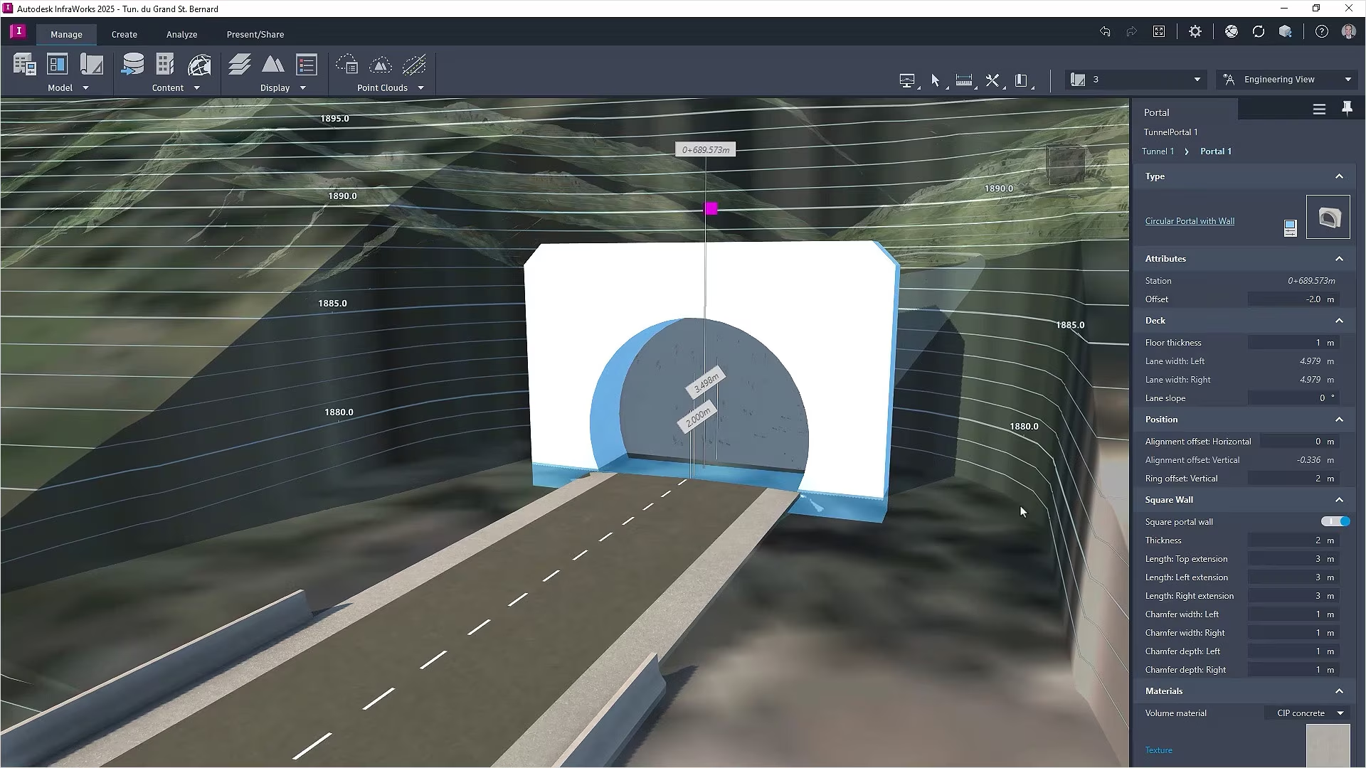
6.1 Planning & Conceptual Design
At the earliest stages, tools like Autodesk InfraWorks and Bentley OpenRoadsConceptStation are used for high-level planning and feasibility studies. These platforms enable planners and engineers to develop preliminary alignments, assess topographical and environmental constraints, and simulate basic traffic or hydrology impacts. Importantly, they interface with GIS data, allowing real-world conditions to inform conceptual models.
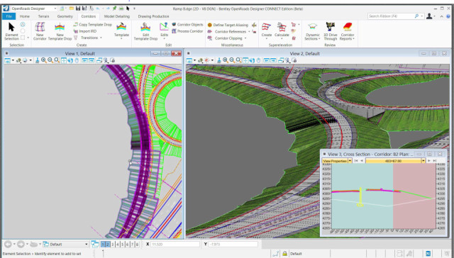
Example: In Kentucky’s DOT pilot projects, conceptual road alignments created in InfraWorks were refined and exported into OpenRoads Designer for detailed design. This seamless transition maintained data integrity and accelerated early decision-making. Tools used –
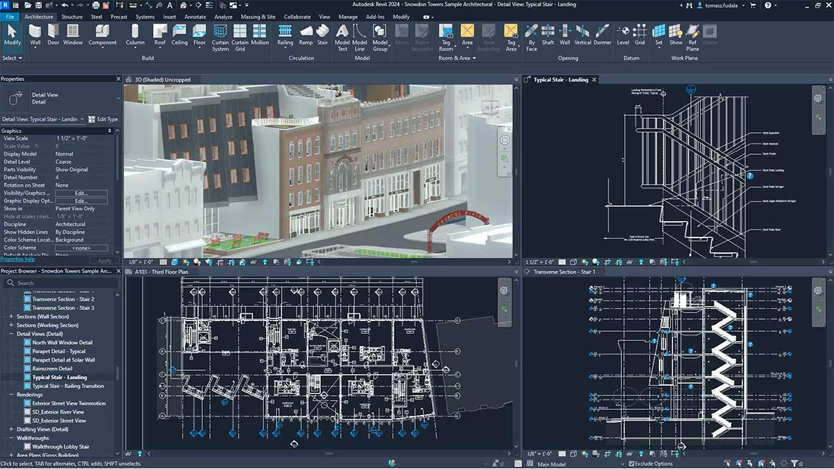
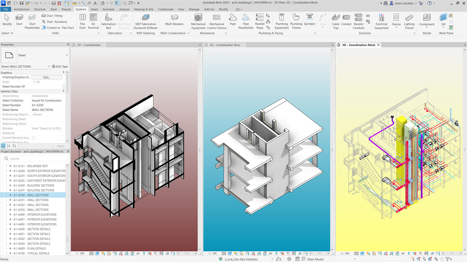
6.2 Design Development, Detailing & Modeling
In the detailed design phase, authoring tools must support parametric modeling, annotation, and multidisciplinary integration. The most common platforms include:
These tools allow engineers to define alignments, section profiles, cross-drainage, and constructability constraints. Their data-rich objects go beyond geometry, embedding materials, performance data, and design rules.
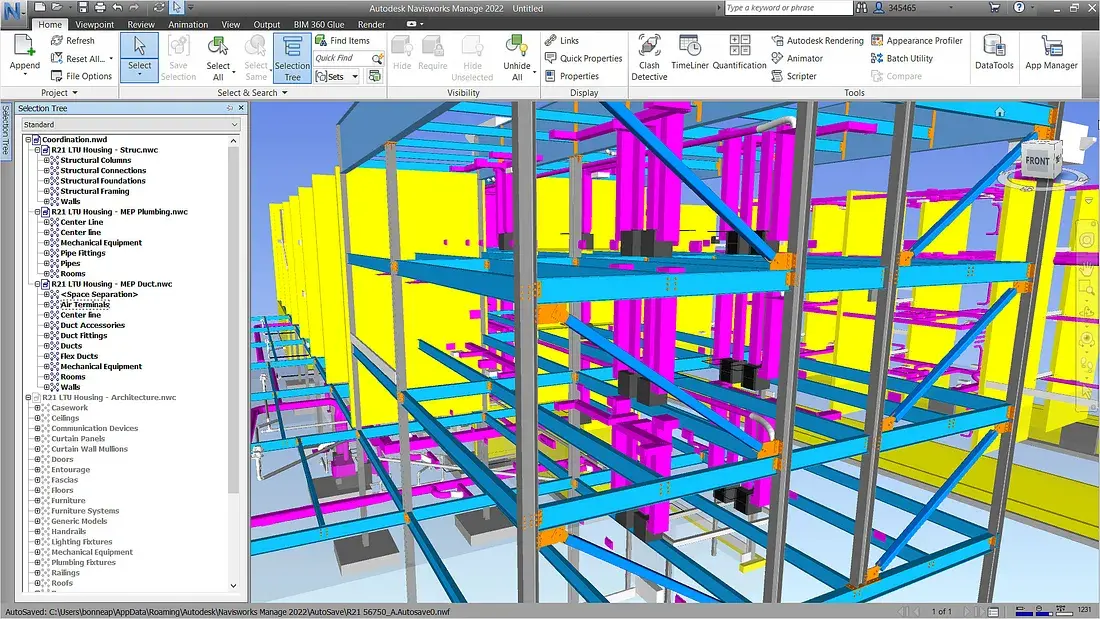
6.3 Construction Sequencing, Model Coordination, and Clash Detection
As multiple models converge (e.g., civil, structural, MEP, utilities), coordination platforms become essential. Autodesk Navisworks is the most commonly used tool for model federation and clash detection. It aggregates models from various disciplines, detects geometric conflicts, and supports markup and issue tracking. Other tools like Solibri or Trimble Connect serve similar purposes, particularly in European contexts.
Lopez also described Sound Transit’s transition from a fixed-tool mandate (e.g., Navisworks) to a more decentralized software approach, allowing project teams to select tools like Revizto or platforms within Autodesk Construction Cloud based on fit. This flexibility supported innovation while still aligning with organizational data standards and ensured buy-in across project teams.
Workflow example: On the SeaTac project, trade partners uploaded weekly models to Autodesk Construction Cloud. Turner’s VDC team ran Navisworks clash reports before each coordination meeting, allowing stakeholders to pre-visualize and resolve spatial conflicts collaboratively.
6.4 AR (4D and 5D Simulation)
To simulate construction sequencing and resource allocation, 4D BIM tools like Synchro Pro, Navisworks Timeliner, and Vico Office link the 3D model with the project schedule (Gantt charts). 5D tools integrate cost data, enabling contractors to analyze budget implications of design options or schedule changes.
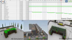
These tools are used to animate construction phasing, coordinate access routes, and optimize work packaging. In Scandinavia, Trafikverket mandates 4D models in tunnel and rail projects to validate safe work sequencing before construction begins.
6.5 Field Execution and Construction Management
BIM is increasingly used in the field through mobile devices and AR/VR platforms. Tools such as:
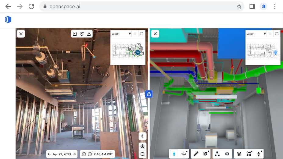
These technologies allow construction teams to verify installation accuracy, document field conditions, and access coordinated models directly at the point of installation.
6.6 Asset Management & Handover
BIM’s value extends beyond handover. As-built models become the foundation for long-term facility operation and asset management. Tools used include:
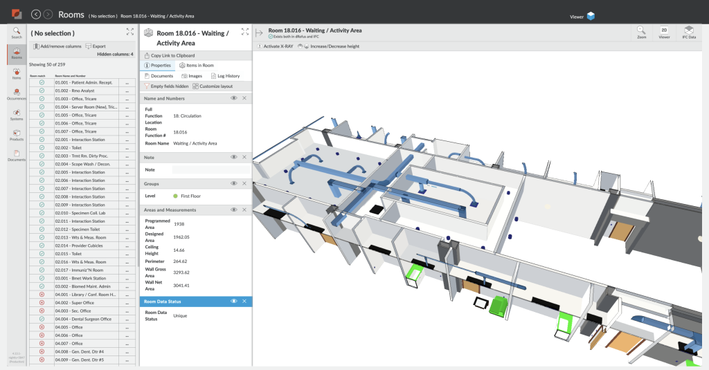
The Common Data Environment (CDE), often hosted on cloud platforms like Autodesk Construction Cloud or Bentley ProjectWise, plays a central role throughout, ensuring data consistency, access control, and lifecycle continuity.
To reinforce lifecycle and FM integration:
Lopez highlighted that Sound Transit’s ultimate goal is “the digital twin of our facilities,” which informs their modeling standards from the outset. This reinforces the need for asset-oriented BIM that remains usable well into operations and maintenance.
7. THEORETICAL FRAMEWORK
A successful transition from 2D to 3D in civil infrastructure using BIM tools cannot be understood through software deployment alone. It is deeply entwined with shifts in communication, institutional culture, and coordination strategies. To investigate these complex transitions, this case study draws upon four theoretical frameworks developed in the literature on BIM-enabled collaboration, primarily from the work of Neff and Dossick:

7.1 Seeing Together
“Seeing together” refers to the collaborative visual experience enabled by shared digital models. Unlike traditional 2D drawings, BIM models allow stakeholders to view and manipulate design intent in 3D space, creating a common visual reference point. This shared visualization supports mutual understanding and reduces misinterpretation. On infrastructure projects with complex geometries—such as tunnels intersecting utility corridors or bridges spanning variable terrain—3D models allow teams to grasp spatial relationships in ways that flat drawings cannot.
In practice, “seeing together” is evident in coordination meetings where participants gather around federated models to explore, query, and resolve clashes. For instance, Turner Construction’s weekly MEP coordination meetings used Navisworks to visualize conflicts between systems and propose real-time solutions. This collective problem-solving builds trust, accelerates decision-making, and aligns team priorities.
7.2 Messy Talk
BIM does not replace human communication—it transforms it. “Messy talk” describes the informal, iterative, and often chaotic dialogue that emerges during collaborative design and coordination. It contrasts with the neatness of finalized documents and highlights the value of back-and-forth negotiation.
In BIM-enabled workflows, messy talk plays out in coordination meetings, site reviews, and design charettes where issues are flagged, ideas are floated, and quick judgments are made. These conversations are often undocumented but essential for resolving conflicts. BIM enables this messiness to happen productively by providing a visual and data-rich context in which people can explore “what if” scenarios and make informed compromises.
7.3 Writing Institutions
The transition to BIM demands more than new tools—it requires rewriting the rules and roles that govern projects. “Writing institutions” refers to the process of embedding BIM practices into contractual, legal, and organizational structures. This includes assigning model ownership, defining Levels of Development (LOD), establishing BIM Execution Plans (BEPs), and aligning deliverables with legal requirements.
Countries like Norway and Sweden have incorporated BIM requirements into public procurement contracts. Similarly, in the United States, many DOTs are beginning to mandate model-based deliverables. These institutional changes are critical. Without them, BIM remains a visual tool rather than a contractual deliverable, and its integration into project workflows remains partial.
7.4 Negotiating Innovation
Adopting BIM is not a one-time event—it is an evolving process. “Negotiating innovation” refers to the ongoing adjustments that teams make as they integrate new tools into existing work cultures. This includes managing resistance, adapting training, modifying schedules, and reallocating responsibilities.
In infrastructure contexts, where legacy systems and entrenched workflows dominate, this negotiation can be particularly complex. Success depends on champions within organizations, cross-disciplinary experimentation, and an openness to adjust institutional roles over time. For example, KICT’s integration of BIM with GIS for facilities management involved months of negotiation between GIS analysts, BIM modelers, and FM teams to align schemas, interfaces, and protocols.
Lopez reinforced this idea, highlighting how Sound Transit identifies BIM “champions”—often younger or newly onboarded professionals unburdened by legacy workflows—who act as innovation catalysts. His strategy involves small pilot projects to test new methods before scaling, an approach that fosters a “fail fast” culture and embeds experimentation within the broader digital transformation.
Together, these four theoretical lenses help frame the deeper social, contractual, and organizational shifts that accompany the adoption of BIM in infrastructure. They allow us to move beyond tool-centric discussions and understand how BIM transforms the very structure of collaboration in large civil projects.
8. THEORETICAL APPLICATIONS AND DISCUSSION
This section synthesizes the findings from real-world case studies and interprets them through the theoretical frameworks discussed earlier. Each project illustrates how BIM not only facilitates technical coordination but also reshapes institutional relationships, communication patterns, and project delivery paradigms. The transition from 2D to 3D is not simply a shift in representation but a transformation in how infrastructure is collaboratively conceived, negotiated, and realized.

8.1 Seeing Together in Practice
“Seeing together” was vividly demonstrated in the SeaTac Concourse C project by Turner Construction. Weekly virtual coordination meetings using Navisworks allowed stakeholders to simultaneously view and discuss federated models. Mechanical contractors, electrical designers, and architects gathered around a common digital space, exploring system layouts, raising issues, and collaboratively resolving them in real time. The ability to navigate a shared 3D model fundamentally changed how problems were visualized and understood.
This visual coordination enabled quicker consensus and avoided misunderstandings typical of 2D interpretations. Similarly, in Scandinavia’s national BIM mandates, field crews using model-based kiosks and tablets interacted with the same 3D views as office-based engineers, aligning work between office and site. These practices made spatial problems tangible and communicable, improving installation accuracy and reinforcing the value of “seeing together.”
8.2 Messy Talk and Informal Collaboration
Throughout the case studies, particularly in Turner and United-BIM’s projects, “messy talk” emerged as a critical dimension of coordination. BIM-enabled workflows did not eliminate informal conversations—in fact, they made them more productive. Coordinators marked up models, floated design alternatives, or iteratively adjusted routing plans while discussing changes over video calls or in co-location spaces.
Rather than rigidly following a top-down communication chain, these teams embraced iterative problem-solving. For example, in United-BIM’s coordination meetings, Navisworks and Revizto were used as dynamic whiteboards where engineers proposed changes and debated routing solutions live. This open-ended dialogue, supported by model visuals, exemplifies the productive messiness that Neff and Dossick describe.
Lopez’s remarks supported this dynamic, referencing what he called “the meeting after the meeting”—a space where informal dialogue continues beyond structured agendas. He confirmed that these off-script conversations often lead to valuable insights that are later formalized through official project channels like RFIs.
8.3 Writing Institutions: Contracts, Ownership, and Legal Models
BIM adoption requires more than digital skills; it necessitates rewriting the institutional rules that shape collaboration. In the Scandinavian examples, BIM was embedded into procurement laws and public contracts. Models, not just drawings, became contractual deliverables. This shift required a redefinition of model ownership, responsibility for data accuracy, and the role of BIM managers.
In KYTC’s implementation of 3D models for machine guidance, model reliability and verification processes had to be legally clarified to avoid liability issues. They developed standardized protocols for model handover and introduced training programs to ensure inspectors could review and approve digital models in lieu of 2D plans.
Lopez noted that Sound Transit’s BIM strategy explicitly follows the principle of “begin with the end in mind”—a concept drawn from Neff and Dossick’s work—aiming to generate usable digital twins for operations. He emphasized the need to standardize deliverables using ISO-19650 and data dictionaries from project inception, to avoid “information tsunamis” and maximize the 97% of data often left unused post-construction.
These changes represent the active “writing of institutions”—aligning legal, contractual, and risk-management frameworks to support model-based delivery. Where this rewriting was absent (e.g., in early U.S. projects), BIM often remained siloed or underutilized, used more as a visualization tool than an integrated deliverable.
8.4 Negotiating Innovation on the Ground
Transitioning to BIM in civil infrastructure requires continual negotiation among stakeholders with different levels of experience, institutional power, and technological comfort. This was most apparent in the Korea Institute of Construction Technology (KICT) case, where GIS experts, FM operators, and BIM modelers had to harmonize different data schemas to create an integrated digital twin environment.
In Turner’s SeaTac project, contractors initially resisted fully model-based workflows due to concerns over learning curves and project schedules. Through regular support, documentation, and feedback loops, these concerns were gradually addressed. This illustrates that innovation is not just introduced—it must be iteratively negotiated.
These examples reaffirm that BIM transformation is as much about process adaptation, relationship management, and cultural evolution as it is about technology. Projects that treated BIM adoption as a collaborative change journey, rather than a technical upgrade, consistently reported higher success rates.
Lopez provided an additional lens, explaining that their BIM adoption was not government-mandated but a proactive agency-level decision. This autonomy allowed Sound Transit to craft its own roadmap while aligning with other regional players such as the Port Authority of New York/New Jersey and the City of Seattle to advocate for future standardization.
9. CONCLUSION
The shift from 2D to 3D coordination using Building Information Modeling (BIM) is more than a technological upgrade—it is a structural transformation in how civil infrastructure is designed, built, and maintained. This case study explored multiple dimensions of that transformation through theoretical frameworks and real-world project implementations.
Findings from projects such as SeaTac Concourse C, KYTC’s highway initiatives, Total BIM adoption in Scandinavia, and KICT’s BIM-GIS integration show that BIM succeeds when embedded into workflows, roles, and contracts—not just software licenses. “Seeing together” and “messy talk” improved communication and reduced ambiguity in spatial problem-solving. “Writing institutions” enabled BIM to become legally valid and operationally required. “Negotiating innovation” highlighted the human and institutional dynamics that shape BIM adoption.
The interview with Justin Lopez reaffirmed these findings. His account of Sound Transit’s BIM transformation—from clash detection to VR walkthroughs, stakeholder buy-in, and digital twin ambitions—illustrates the multifaceted process of embedding BIM into institutional DNA.
BIM improved coordination accuracy, shortened design cycles, reduced rework, and opened pathways to prefabrication and automation. However, these gains depended on the presence of model-based contracts, leadership commitment, workforce training, interoperable tools, and collaborative culture. The projects that leveraged BIM as a platform for coordination—not just visualization—achieved the most transformative results.
10 . RECOMMENDATIONS
1. Institutionalize BIM in Contracts and Standards
Public infrastructure agencies should adopt BIM Execution Plans (BEPs) as contractual requirements and define model LODs, ownership, and approval protocols. BIM must be positioned not just as a tool but as a deliverable with legal standing.
2. Invest in Capacity Building and Field-Level Enablement
Training must extend beyond BIM coordinators to include inspectors, field engineers, trade partners, and facility managers. Mobile BIM apps, AR tools, and visual dashboards should be provided to ensure that 3D coordination benefits are realized on-site.
3. Mandate Interoperability and Data Longevity
Use of open standards like IFC, LandXML, and CityGML should be prioritized. Models should be validated not only for design compliance but for downstream uses such as fabrication, simulation, and operations. Cloud-hosted Common Data Environments (CDEs) should centralize data access.
4. Support Culture Change through Collaborative Processes
Co-location spaces, weekly coordination meetings, and cross-disciplinary BIM reviews should be routine. Leadership must encourage “messy talk” and visual problem-solving over documentation-heavy chains of command.
5. Align Procurement with Digital Delivery Goals
Agencies must revise procurement processes to reward integrated delivery, early contractor involvement, and model-based submittals. This includes scoring RFQs based on digital capabilities and prefabrication readiness.
6. Embrace Lifecycle Thinking
Models should not be discarded post-construction. FM-integrated BIM must be tied into asset management systems to enable predictive maintenance, energy optimization, and post-occupancy analysis.
7. Learn from Global Best Practices
Scandinavia’s Total BIM, Korea’s BIM-GIS integration, and Turner’s MEP coordination workflow offer proven pathways. Governments and private clients should support pilot projects, case study dissemination, and knowledge exchange forums.
In summary, the true value of BIM in civil infrastructure lies not just in visualization or clash detection, but in transforming how infrastructure systems are collaboratively imagined, negotiated, and delivered. The move from 2D to 3D requires a parallel evolution in contracts, roles, communication, and planning practices. With the right institutional support and cultural alignment, BIM can serve as the foundation for more resilient, efficient, and transparent infrastructure delivery.
11. Acknowledgments
I would like to express my sincere gratitude to Justin Lopez, BIM Program Manager at Sound Transit, for generously sharing his insights and experiences. His practical perspectives on BIM implementation, organizational strategy, and innovation in public infrastructure played a pivotal role in shaping the direction and depth of this case study.
12. REFERENCES
Media Attributions
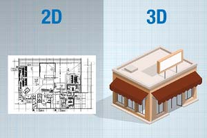
- 2D & 3D Workflow in Revit is licensed under a All Rights Reserved license
- Shared/Federated 3D Model is licensed under a All Rights Reserved license
- Horizontal Construction Importance © RahulAlluri is licensed under a All Rights Reserved license
- 2D to 3D Transition is licensed under a All Rights Reserved license
- Real-World Case Studies © RahulAlluri is licensed under a All Rights Reserved license
- Key Softwares and Workflows © RahulAlluri is licensed under a All Rights Reserved license
- Autodesk Infraworks is licensed under a All Rights Reserved license
- Bentley OpenRoads is licensed under a All Rights Reserved license
- Autodesk Revit is licensed under a All Rights Reserved license
- Clash detection in Navisworks is licensed under a All Rights Reserved license
- Synchro 4D is licensed under a All Rights Reserved license
- OpenSpace Software is licensed under a All Rights Reserved license
- dRofus Software is licensed under a All Rights Reserved license
- Theoretical Frameworks © RahulAlluri is licensed under a All Rights Reserved license
- Theoretical Applications © RahulAlluri
